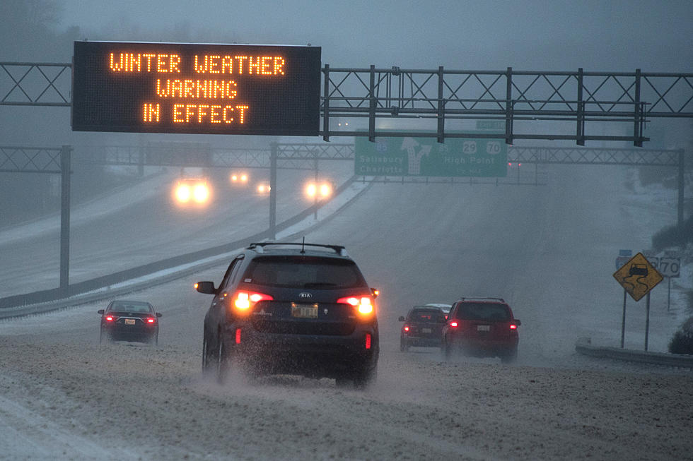
High Wind and Blizzard Warning With Dangerous Travel Conditions In CNY
The National Weather Service (NWS) is calling for strong, potentially damaging winds, lake effect show with significant blowing and drifting. We could see tree damage, difficult travel conditions with scattered power outages.

...BLIZZARD WARNING REMAINS IN EFFECT UNTIL 4 AM EST TUESDAY...
* WHAT...Blizzard conditions expected. Total snow accumulations
of 5 to 10 inches expected along and north of the Thruway,
with 3 to 6 inches south. Significant drifting snow expected.
Winds gusting as high as 65 mph on Monday, then 35 to 45 mph
Monday night.
* WHERE...Southern Oneida County.

* WHEN...From 4 AM today to 4 AM EST Tuesday. Worst conditions
expected this afternoon and evening.
* ADDITIONAL DETAILS...Travel will likely be very difficult or
impossible with areas of blowing snow significantly reducing
visibility. Hazardous conditions are expected to impact the
morning and evening commutes on Monday. Strong winds could
cause tree and power line damage.
PRECAUTIONARY/PREPAREDNESS ACTIONS...
A Blizzard Warning means severe winter weather conditions are
expected or occurring. Falling and blowing snow with strong winds
and poor visibilities are likely. This will lead to whiteout
conditions, making travel extremely dangerous. Do not travel. If
you must travel, have a winter survival kit with you. If you get
stranded, stay with your vehicle.

...HIGH WIND WARNING REMAINS IN EFFECT UNTIL 7 PM EST THIS
EVENING...
* WINDS...West 30 to 45 mph with gusts to 60 mph.

* TIMING...Through early Monday evening. Peak winds likely this
morning.
* IMPACTS...Damaging winds will blow down trees and power lines.
Widespread power outages are expected. Travel will be
difficult, especially for high profile vehicles.
Extended NWS Forcast:
Today: Snow showers. Areas of blowing snow. High near 25. Windy, with a west wind 31 to 33 mph, with gusts as high as 55 mph. Chance of precipitation is 80%. Total daytime snow accumulation of around 3 inches.
Tonight: Snow showers, mainly before 2am. The snow could be heavy at times. Areas of blowing snow before 2am. Low around 8. Wind chill values as low as -9. Windy, with a west wind 20 to 29 mph, with gusts as high as 49 mph. Chance of precipitation is 90%. New snow accumulation of around 4 inches.
Tuesday: A slight chance of snow showers before 11am. Partly sunny, with a high near 16. Wind chill values as low as -9. Northwest wind 16 to 18 mph, with gusts as high as 31 mph. Chance of precipitation is 20%.
Tuesday Night: Mostly cloudy, with a low around 1. Wind chill values as low as -9. Northwest wind 7 to 15 mph, with gusts as high as 25 mph.
Wednesday: Snow likely, mainly after 2pm. Mostly cloudy, with a high near 20. Northeast wind around 6 mph becoming south in the afternoon. Chance of precipitation is 70%.
Wednesday Night: Snow likely, mainly before 2am. Cloudy, with a low around 13. Chance of precipitation is 70%.
Thursday: Mostly cloudy, with a high near 30.
Thursday NightMostly cloudy, with a low around 17.
Friday: A chance of snow between 8am and 2pm, then a chance of rain after 2pm. Mostly cloudy, with a high near 36. Chance of precipitation is 30%.
Friday Night: A chance of rain before 8pm, then a chance of snow. Mostly cloudy, with a low around 28. Chance of precipitation is 50%.
Saturday: A chance of rain and snow. Cloudy, with a high near 40. Chance of precipitation is 50%.
Get up to information on power outages throughout Central New York; where it’s out and when it’ll be restored with National Grid’s Power Outage Map.
National Grid also offers text alerts on the latest efforts to restore power.
To receive free text message alerts and updates, text the word STORM to NGRID (64743). E-mail alerts are available to customers who create an online profile on the company’s website. All alert services can be started and stopped at the customer’s request.
You can even report power outages or get the latest information at National Grid’s website.
Power Outage Preparation:
*Keep your cell phone charged and make sure you know where your backup power supply is.
*Make sure all your flashlights have fresh batteries.
*Fill your gas tank. You can use your car to keep warm and recharge devices.
*Have some food available that you don’t need to cook.
* Download The Eagle App. You’ll receive local alerts, weather reports and more with push notification.
[NWS]
More From 96.9 WOUR