Spring Coastal Storm Brings Heavy Snow And 40 MPH Winds To CNY
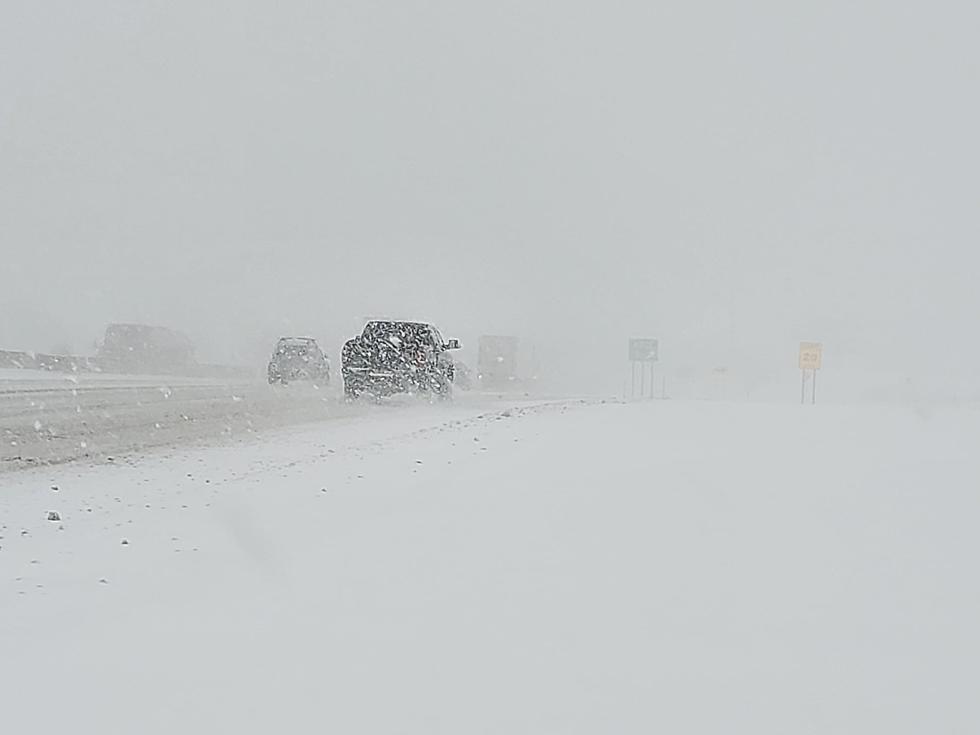
Heavy snow is creating difficult travel across CNY. We'll have a brief break in the action before round 2 starts late today into tonight.
...WINTER STORM WARNING REMAINS IN EFFECT UNTIL 8 AM EDT
SATURDAY...
* WHAT...Heavy snow. Additional snow accumulations of 6 to 12 inches above 1400 foot elevation, and 3 to 6 inches at lower elevations. Winds gusting as high as 40 mph late today through tonight.
* WHERE...In Pennsylvania, Northern Wayne County. In New York, Delaware, Otsego, Oneida, Cortland, Onondaga, Chenango, and Madison counties.
* WHEN...Wet and occasionally heavy snow early this morning, mainly at higher elevations. Lull midday with light mixed rain and snow, but then heavier snow showers and blowing snow late this afternoon through tonight.
* ADDITIONAL DETAILS...Travel could be very difficult, especially at higher elevations. Areas of blowing snow could significantly reduce visibility. The hazardous conditions could impact the morning or evening commutes.
PRECAUTIONARY/PREPAREDNESS ACTIONS...
A Winter Storm Warning for snow means severe winter weather conditions will make travel very hazardous or impossible. If you must travel, keep an extra flashlight, food and water in your vehicle in case of an emergency.
- VERY elevation-dependent snow. At least a little snow for most of the area, but
heaviest snowfall will be over higher elevations along/east of Interstate 81 in
Central NY into northern Wayne County PA. - Wet snow early this morning with potential for heavy amounts, especially above
1400 feet elevation east of Interstate 81. Some snowmelt during the day, with a
spotty light rain/snow mix. - Another round of snow develops across NY and PA late this afternoon through tonight, with gusty west-northwest winds and blowing snow. Amounts again
greatest at higher elevations. - Snowfall rates may exceed an inch per hour at times early this morning at higher elevations. Up to one inch per hour rates within heaviest snow showers late this afternoon through tonight.
- Main impact: Hazardous travel (snow-covered roads, low visibilities),
especially higher elevations.
NWS Forcast:
Today: Rain and snow. High near 37. West wind 6 to 15 mph, with gusts as high as 25 mph. Chance of precipitation is 100%. Total daytime snow accumulation of around an inch possible.
Tonight: Snow. Areas of blowing snow before 10pm. Low around 23. Blustery, with a northwest wind 17 to 21 mph, with gusts as high as 36 mph. Chance of precipitation is 80%. New snow accumulation of around 3 inches.
Saturday: A chance of snow showers, mainly before 10am. Cloudy through mid morning, then gradual clearing, with a high near 30. Breezy, with a west wind 17 to 21 mph, with gusts as high as 31 mph. Chance of precipitation is 40%. New snow accumulation of less than a half inch possible.
Saturday Night: Mostly clear, with a low around 23. West wind 10 to 14 mph.
Sunday: Sunny, with a high near 48. West wind 6 to 14 mph.
Sunday Night: A chance of snow showers after 2am. Mostly cloudy, with a low around 30. Chance of precipitation is 40%.
Monday: A chance of snow showers before 2pm. Mostly cloudy, with a high near 38. Chance of precipitation is 30%.
Monday Night: Mostly cloudy, with a low around 15.
Tuesday: Mostly sunny, with a high near 30.
Tuesday Night: Mostly clear, with a low around 15.
Wednesday: Sunny, with a high near 41.
Wednesday Night: Partly cloudy, with a low around 26.
Thursday: Mostly sunny, with a high near 52.
Download the Eagle App You’ll receive local alerts, weather reports and more with push notifications.
More From 96.9 WOUR