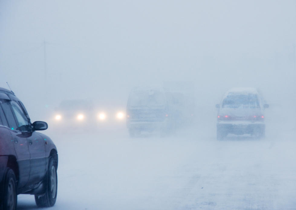
Sleet, Freezing Rain And Gusty Winds Will Cause Slippery Travel In CNY
The National Weather Service (NWS) out of Binghamton has issued a Winter Weather Advisory From 10 PM this evening to 7 AM Tuesday.
NWS says we'll see some brief very light snow or sleet will be this afternoon. However, wintry mix including some freezing rain becomes more likely this evening through tonight, along with gusty winds at higher elevations. After mainly rain showers Tuesday, a cold pattern will take hold for the remainder of the week with snow showers.
...WINTER WEATHER ADVISORY IN EFFECT FROM 10 PM THIS EVENING TO
7 AM EST TUESDAY...
* WHAT...Mixed precipitation expected. Ice accumulations of a
light glaze, and total snow accumulations of less than one inch
expected. Winds gusting as high as 35 mph.
* WHERE...In Southern Oneida, Chenango, Otsego, Tioga, Broome, Delaware and Sullivan counties.
* WHEN...From 10 PM this evening to 7 AM Tuesday.
* ADDITIONAL DETAILS...Plan on slippery road conditions.
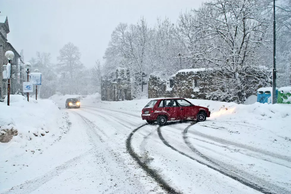
A Winter Weather Advisory means that periods of snow, sleet or freezing rain will cause travel difficulties. Expect slippery roads and limited visibilities, and use caution while driving.
Main concerns are the likelihood of a light glaze of ice areawide tonight, as well as accumulating snow mainly for northern Oneida County, and gusty winds for higher elevations of Central New York.
NWS Extended Forecast:
Today: A chance of light snow after 5 pm. Increasing clouds, with a high near 26. Light and variable wind becoming southeast 6 to 11 mph in the afternoon. Chance of precipitation is 30%. Total daytime snow accumulation of less than a half inch possible.
Tonight: Snow, freezing rain, and sleet likely before 1 am, then freezing rain and sleet between 1 am and 3 am, then snow, freezing rain, and sleet after 3 am. Low around 22. Southeast wind 14 to 17 mph, with gusts as high as 30 mph. Chance of precipitation is 90%. New ice accumulation of less than a 0.1 of an inch possible. New snow and sleet accumulation of less than one inch possible.
Tuesday: A chance of snow and freezing rain before 8 am, then a chance of rain and snow showers between 8 am and 9 am, then a chance of rain showers after 9 am. Cloudy, with a high near 41. South wind 6 to 11 mph. Chance of precipitation is 40%. New snow accumulation of less than a half inch possible.
Tuesday Night: Rain and snow showers, becoming all snow after 1 am. Low around 33. Light and variable wind becoming west 5 to 9 mph after midnight. Chance of precipitation is 80%. New snow accumulation of around 3 inches.
Wednesday: Snow showers likely. Cloudy, with a high near 35. West wind 11 to 14 mph. Chance of precipitation is 70%.
Wednesday Night: A chance of snow showers. Cloudy, with a low around 22. Chance of precipitation is 40%.
Thursday: A chance of snow showers. Cloudy, with a high near 24. Chance of precipitation is 30%.
Thursday Night: Mostly cloudy, with a low around 7.
Friday: Partly sunny, with a high near 15.
Friday Night: Mostly cloudy, with a low around 4.
Saturday: Partly sunny, with a high near 20.
Saturday Night: Mostly cloudy, with a low around 7.
Sunday: Partly sunny, with a high near 24.
Take us everywhere you go with our new App. Listen live with all of your favorite shows with fewer commercials. The new app lets you call, message or tweet at us anytime or send us photos and videos. The app also gives you the ability to receive notifications about breaking news, weather alerts, traffic advisories and school closings happening in and around Central New York.
Winter Weather Preparation:
- Keep your cell phone charged and make sure you know where your backup power supply is.
- Make sure all your flashlights have fresh batteries.
- Fill your gas tank. You can use your car to keep warm and recharge devices.
- Have some food available that you don’t need to cook.
- Download the WOUR App You’ll receive local alerts, weather reports and more with push notifications.
More From 96.9 WOUR